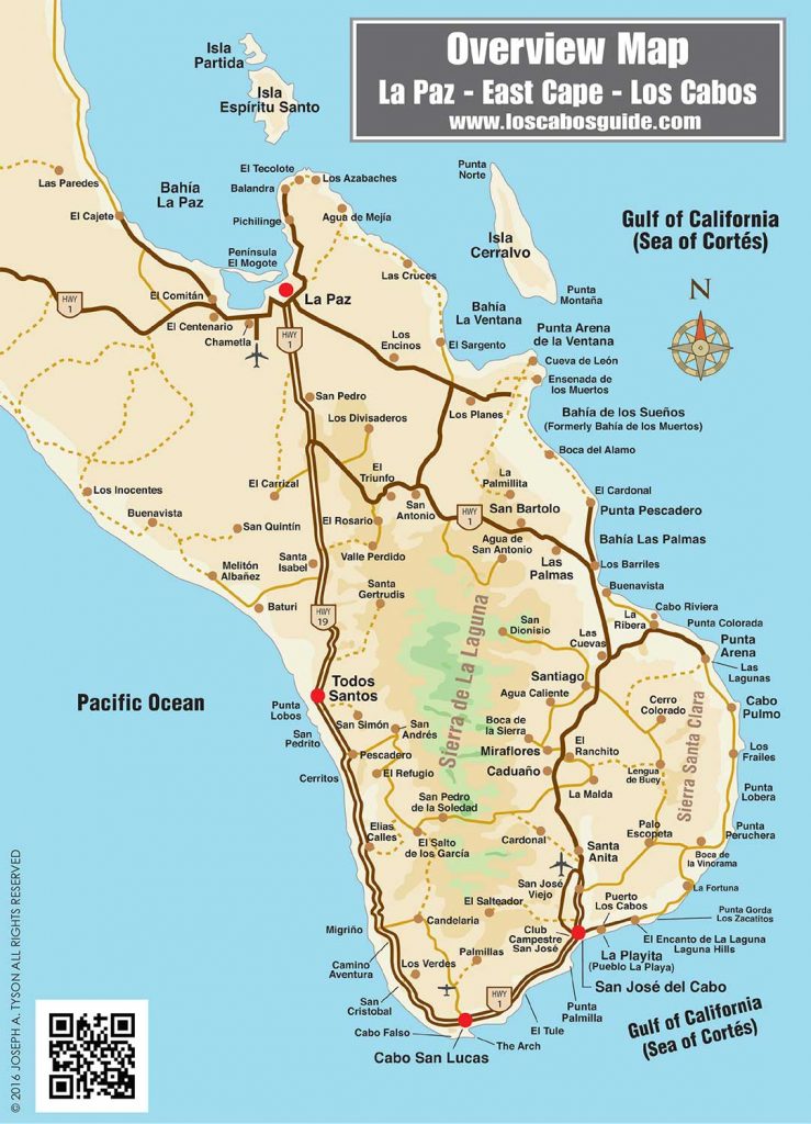
Cabo San Lucas, San José del Cabo, Los Cabos, and East Cape Area, Baja California Sur, México.
What started as a pair of sleepy fishing villages has transformed into the world-class, cosmopolitan travel destination known as Los Cabos. Whether you are seeking to navigate Cabo San Lucas, San Jose del Cabo, the Tourist Corridor that connects them, the East Cape, Punta Arena, or the underwater canyon of Cabo San Lucas Bay, Los Cabos Guide has the map for you.
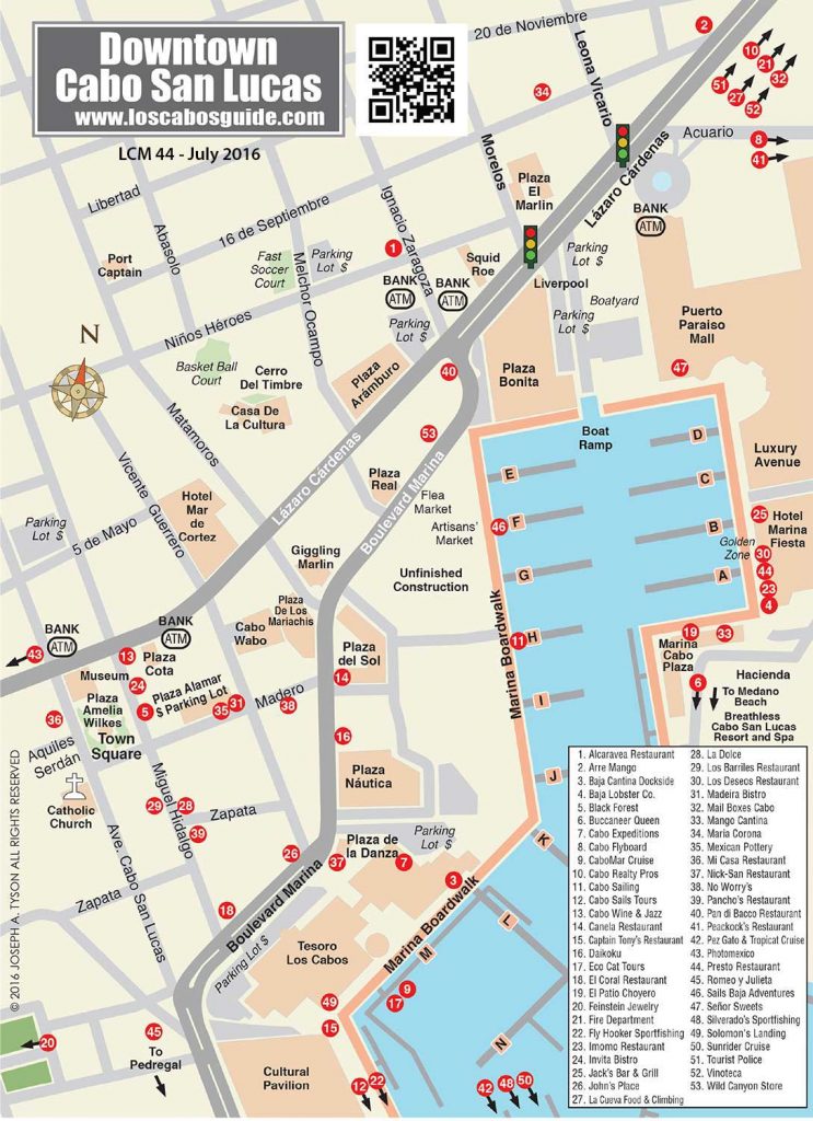
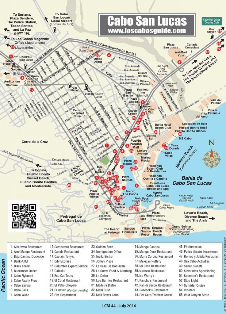
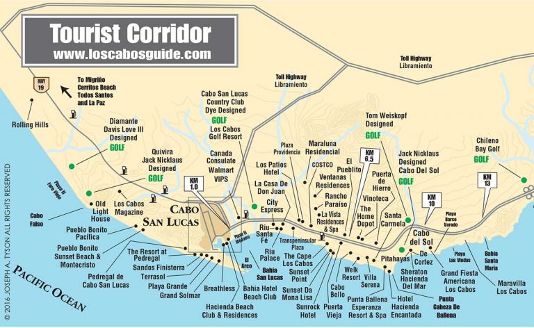
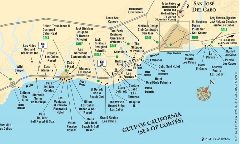
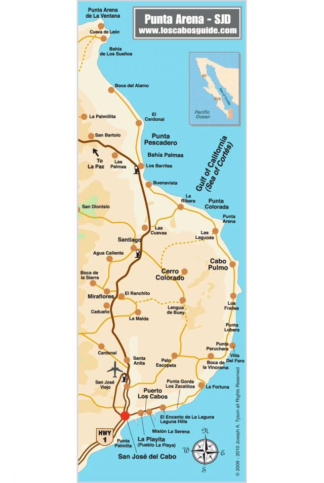
This page features thumbnail-sized maps with links to detailed larger versions. Among them you will find Cabo San Lucas, downtown Cabo San Lucas, San Jose del Cabo, downtown San Jose del Cabo, the Tourist Corridor, the East Cape, the Underwater Canyon of Cabo San Lucas Bay, and an overview map of the greater Los Cabos region.
Review Los Cabos Guide’s routinely updated maps to locate various points of interest, including hotels, restaurants, shopping centers, golf courses, and beaches throughout the Los Cabos region of Baja California Sur, Mexico.
Each or our Cabo San Lucas, Los Cabos maps contains detailed information about street names, shopping malls, activity centers, service centers, and notable landmarks. Enjoy the thrill of exploring this unique corner of the world—without having to worry about getting lost.
Discover the breathtaking beauty and vibrant culture of Los Cabos, where azure waters meet golden shores and adventure awaits at every turn.